

New and updated datasets are those that have been added to or modified most recently in the Hub. Data that has been added in the last 30 days will display a green leaf icon and you can explore all the new and recently updated datasets by clicking the 'View More' link in the section below.
-
Jan 2020 - Dec 2070
2022 State Water Plan Water User Group Water Management Strategy Supply


- CSV
2022 Interactive State Water Plan application statewide download of water user group (WUG) recommended water...
- CSV
-
Jan 2020 - Dec 2070
2022 State Water Plan Water User Group Water Supply Needs
- CSV
2022 Interactive State Water Plan application statewide download of water user group (WUG) water supply needs by...
- CSV
-
Jan 2020 - Dec 2070
2022 State Water Plan Water User Group Existing Supplies
- CSV
2022 Interactive State Water Plan application statewide download of water user group (WUG) existing supplies by WUG's...
- CSV
-
- SHP
The 16 Water Planning Regions in Texas, as created by the Texas Water Development Board (TWDB), updated November...
- SHP
Applications are digital tools that bring together information to tell a story, assist with decision making, or provide additional context for a user. When available, the Hub makes every effort to link datasets and applications so that users are able to explore through expertly crafted tools and download the data.
-
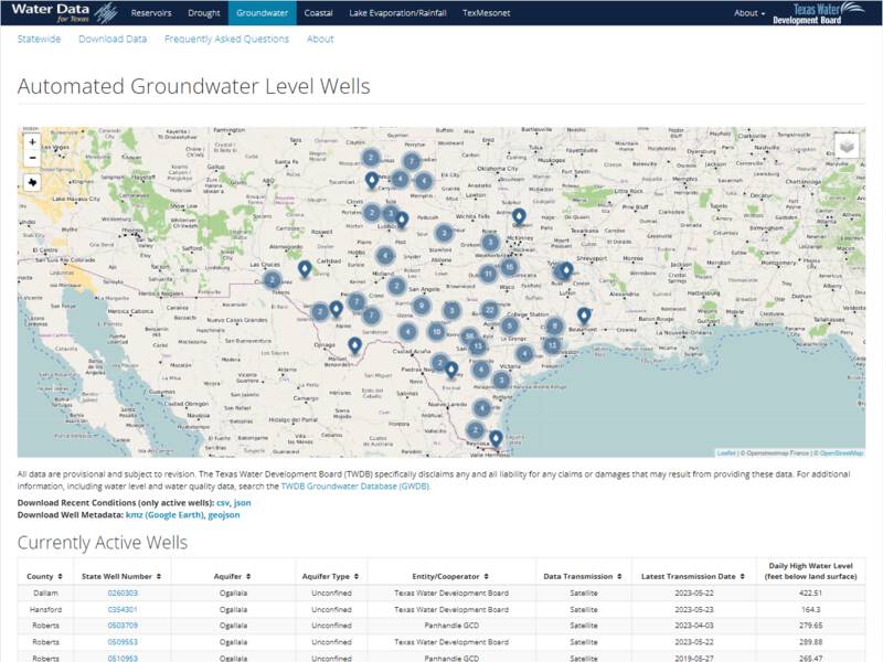
Water Data for Texas: Groundwater
Water Data for Texas is a product of the Texas Water Development Board (TWDB) Water Science Conservation Division and...
-
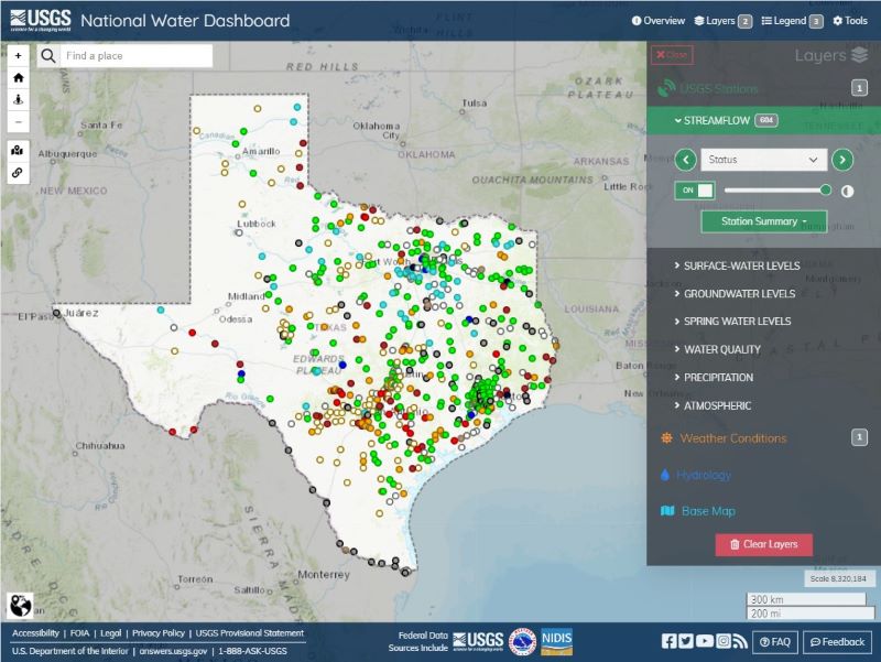
National Water Dashboard
This viewer shows provisional real-time water data collected at the U.S. Geological Survey (USGS) observation...
-
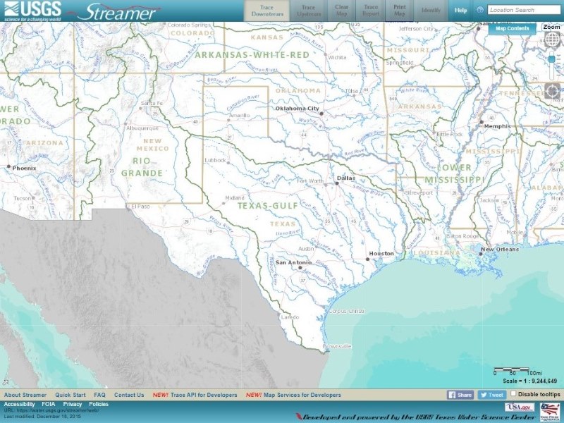
Streamer
Streamer is an online mapping application for exploring downstream and upstream along America’s rivers and streams....
-
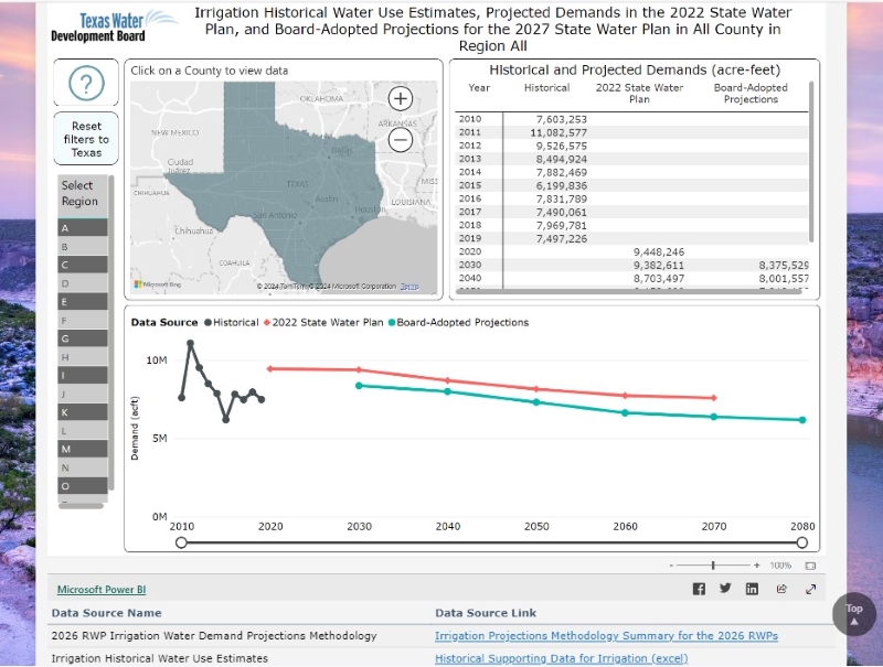
2026 Regional Water Plans Board-Adopted Non-Municipal Water Demand Projections
The data in this interactive dashboard supports the 6th regional water planning cycle. The dashboard tabs have...
Statewide data in the Hub are datasets covering more than 50% of the state, comprehensive and complete data resources of that type for the state, or those that contain widely spatially dispersed information with data points located all across the state (not just in specific regions).
-
- SHP
Geographic Information System shapefile of Groundwater Database well locations, updated nightly.
- SHP
-
- TXT
The Texas Water Development Board (TWDB) Groundwater Database (GWDB) contains information on selected water wells,...
- TXT
-
- SHP
Geographic Information System shapefile of Submitted Drillers Report (SDR) Database well locations, updated nightly.
- SHP
-
- TXT
The Submitted Drillers Report (SDR) Database is populated from the online Texas Well Report Submission and Retrieval...
- TXT