-
 5 Datasets
Community Collaborative Rain, Hail & Snow Network Data Explorer
The goal of the Data Explorer is to provide observers and other users easy access to their data using innovative data...
5 Datasets -
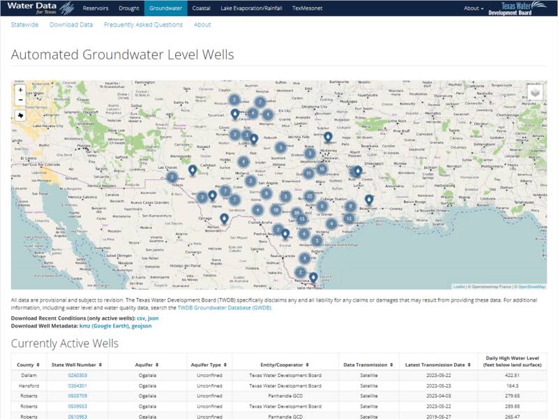
Water Data for Texas: Groundwater
Water Data for Texas is a product of the Texas Water Development Board (TWDB) Water Science Conservation Division and...
-
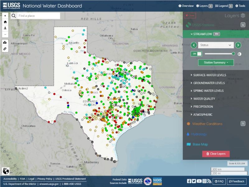
National Water Dashboard
This viewer shows provisional real-time water data collected at the U.S. Geological Survey (USGS) observation...
-
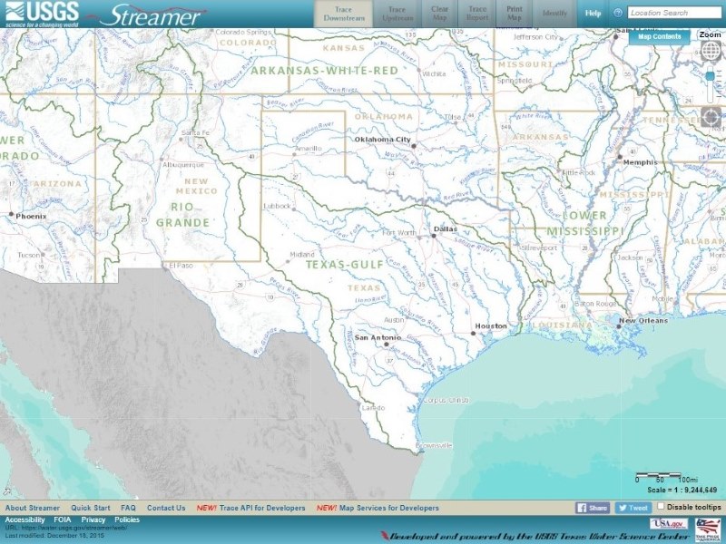
Streamer
Streamer is an online mapping application for exploring downstream and upstream along America’s rivers and streams....
-
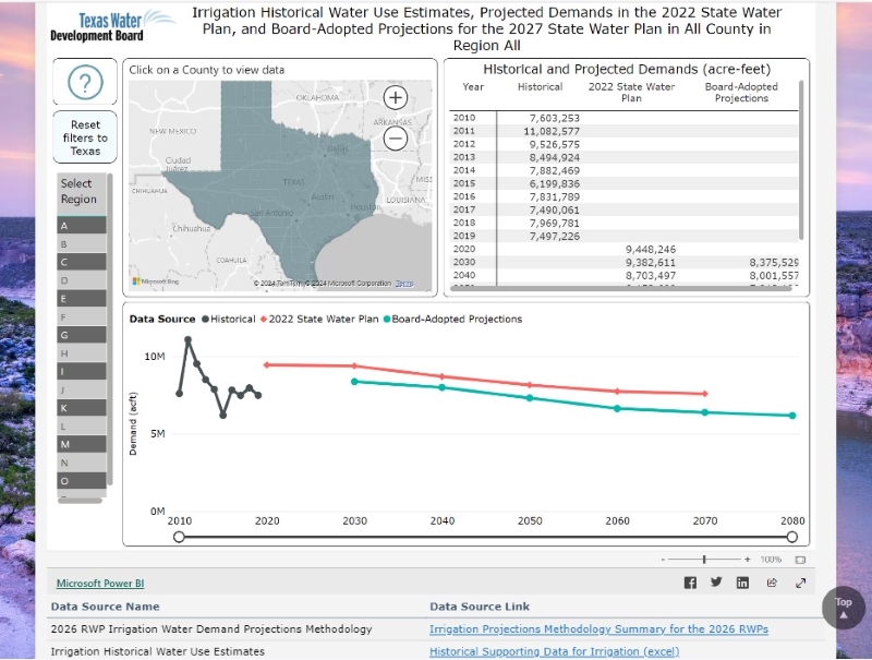
2026 Regional Water Plans Board-Adopted Non-Municipal Water Demand Projections
The data in this interactive dashboard supports the 6th regional water planning cycle. The dashboard tabs have...
-

2026 Regional Water Plan Board-Adopted Population and Municipal Demand Projec...
The data in this interactive dashboard supports the 6th regional water planning cycle. Population projections utilize...
-

Water Well Report Viewer

The Water Well Report Viewer allows users to locate and review copies of over 800,000 historical reports for water...
-

Flood Inundation Mapper
The FIM Mapper allows users to explore the full set of inundation maps that shows where flooding would occur given a...
-
 1 Dataset
Texas Stream Team Datamap
The Texas Stream Team Datamap is a user-friendly mapping tool designed to show community science water quality...
1 Dataset -
 2 Datasets
Interactive 2022 State Water Plan
This website lets water users statewide take an up-close look at the 2022 State Water Plan data and how water needs...
2 Datasets